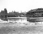
In celebration of the recent kibosh on the Ford brothers’ grotesque vision of the waterfront, let’s review some cool points in our shoreline history! Toronto’s past has been adventurous, slightly sinister, and pretty much full of the stuff that life is really all about: whiskey, sugar, and kidnappin’s. Up until now though, we’ve been ice palace free. Let’s keep it that way!
1793 – The old town of York (the city we now call home) is established in the 10 original blocks between today’s Adelaide and Front St. There are 3 wharves for shipping – one on Peter St, one on Church St. and one on Sherbourne St. The one on Church St., Cooper’s wharf, is the happening place to see and be seen. All that remains of it now is Cooper St., a nondescript empty block between Loblaws and the LCBO at Lakeshore Blvd.
1818 – Trade by boat invites lots of manufacturing facilities around the waterfront, which by this time is become a grimy mess of wharves. The Mall, a public esplanade, is built to try to make it more liveable. From Peter St to Parliament, trees are planted, sewage drainage pipes are diverted into the water, and people max and relax by the water.
1830 –The hotels of the time – The Steamboat, (where today’s Market Square is), The Wellington (the Flat Iron Building) and Ontario house (Pizza Pizza) all have ballin’ verandas looking over the lake just steps away.
1831 – An English merchant named William Gooderham and his family move to the city and The Gooderham and Worts Distillery opens. In 1833, Worts’ wife dies and he promptly throws himself into the company well. Goodherham keeps on truckin’, and by 1837, the distillery, originally conceived as a plant to make flour, is producing more than 110 000 L of whiskey per year. In 1877, it’s the largest distillery in the world.
1833 – Hugh Richardson is named as Toronto’s first harbourmaster. This captain from London England was kidnapped by French pirates in 1810, and imprisoned in Paris where he stayed for 8 years. The year he is free he gets hitched and moves to Canada where he pours his heart and soul into the waterfront, publishing a DIY newsletter and paying for buoys and beacons from his own pocket. He holds the position till 1870.
1834 – The city of Toronto is established. The harbour continues to expand along with the city, and has close to 30 wharves and piers by now.
1840’s – The merchant class, who occupy most of the houses by the water, begin to move away. Those left behind are forced to slum it in deteriorating shacks that faced the backs of crumbling storehouses. The tenements around Lower Jarvis St. could typically see 20 families jammed into a few damp rooms.
1850’s –The first railway lines come to Toronto with the majority of their tracks on the waterfront promenade. By the 1880’s, the harbour is handling 1 250 000 passengers annually.
1873 – Historian Henry Scadding writes in his book Toronto of Old, the waterfront “has done for Toronto what the Thames Embankment has done for London”
1879 – 80 buildings stand where Market Square is now, and 30 where St. James Park is now. The area around St. James’s Park is a horrific ghetto where city hall is also located. During the late 1800’s, public housing is unheard of; construction is for profit, not for the needs of people.
1904 – A mysterious fire wipes out 122 buildings along Bay, Front, Willington and Esplanade leaving 5000 people out of work.
1930’s –The waters of Hanlan’s Bay on the western point of the islands are filled and Billy Bishop Toronto city airport is made.
1950 – The Gardiner Expressway is built so people can drive in from the ‘burbs more easily.
1970’s –Major cities around the world are starting to rediscover their waterfronts, and Toronto follows suit. The “Harbourfront Project” is established. Condos are built on the shoreline, while the area east of Yonge remains in light industrial use. A few buildings remain from the industrial period, like the Redpath sugar factory.
1988 – The public is officially pissed at how botched everything is around the waterfront, so Prime Minister Mulroney calls another Royal Commission into the waterfront and a detailed, expensive plan of development came about that totally ended up flopping.
2001 – Waterfront Toronto is established, one of the largest urban redevelopment projects in North America. Full revitalization is estimated to take up to 25 – 30 years and about $17 billion. As of 2008, most of the lands to the east of Yonge St around the Don River are planned for redevelopment by Waterfront Toronto. The plan calls for a mixed use community with libraries, daycares, 13000 residential units, retail and commercial space, 130 acres of parks and public space, and a waterfront park.
August 2011 – But wait, Rob Ford has a brilliant idea. He launches an “absolutely phenomenal” scheme to transform the Port Lands into a paradise of Ferris wheels, ice palace sports zones, and unicorns with money that doesn’t exist. He doesn’t want to wait quarter century either; Robby Rob’s plan is projected to take 10.
September 2011 – Opposition to Ford’s vision explodes, with 147 influential folks issuing a letter describing the plan as “window dressing for an old fashioned land deal.”
Sept. 21 2011 – Toronto city council officially kiboshes Ford’s plan, voting unanimously in favour of Waterfront Toronto to remain in control of the port lands development plan. Long live our murky and marvelous harbour!
~ Kait Fowlie


 Follow Us On Instagram
